MARINO PH
Your Maritime Digital Hub

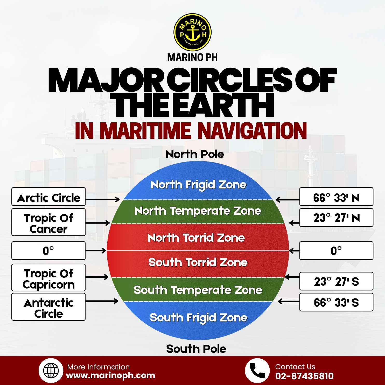
The Earth is divided into several major circles that play an important role in maritime navigation, geography, climate study, and global positioning,. These imaginary lines help seafarers identify locations, understand weather conditions, and navigate safely across different oceans and seas around the world.
The Equator, located at 0° latitude, is the main reference line that divides the Earth into the Northern Hemisphere and Southern Hemisphere. Areas near the Equator experience warmer temperatures and are commonly known as the Torrid Zone. In maritime operations, vessels crossing this region often encounter tropical weather systems, heavy rainfall, and high humidity.
ADVERTISEMENT
North of the Equator is the Tropic of Cancer at 23°27’ North, while south of the Equator is the Tropic of Capricorn at 23°27’ South. These lines mark the boundaries where the sun can appear directly overhead during certain times of the year. Between these tropical circles lies the tropical climate region, which greatly affects ocean currents, wind systems, and weather patterns important to navigation.
Further north is the Arctic Circle at 66°33’ North, while the Antarctic Circle is located at 66°33’ South. These circles define the polar regions of the Earth. Areas beyond these lines experience extreme cold temperatures, long periods of daylight during summer, and extended darkness during winter. Ships operating in these regions must prepare for icy waters, strong winds, and difficult navigation conditions.
The North Pole and South Pole are located at the northernmost and southernmost points of the Earth. These regions are essential references in global navigation, charting, and geographic positioning systems used by mariners worldwide. Understanding the major circles of the Earth helps seafarers improve route planning, weather awareness, and overall navigational safety during voyages across international waters.